🎉 Up to 70% Off Selected ItemsShop Sale

Los Angeles County Map - Regions Colorized (No Zip Codes) - FILES - PDF and AI
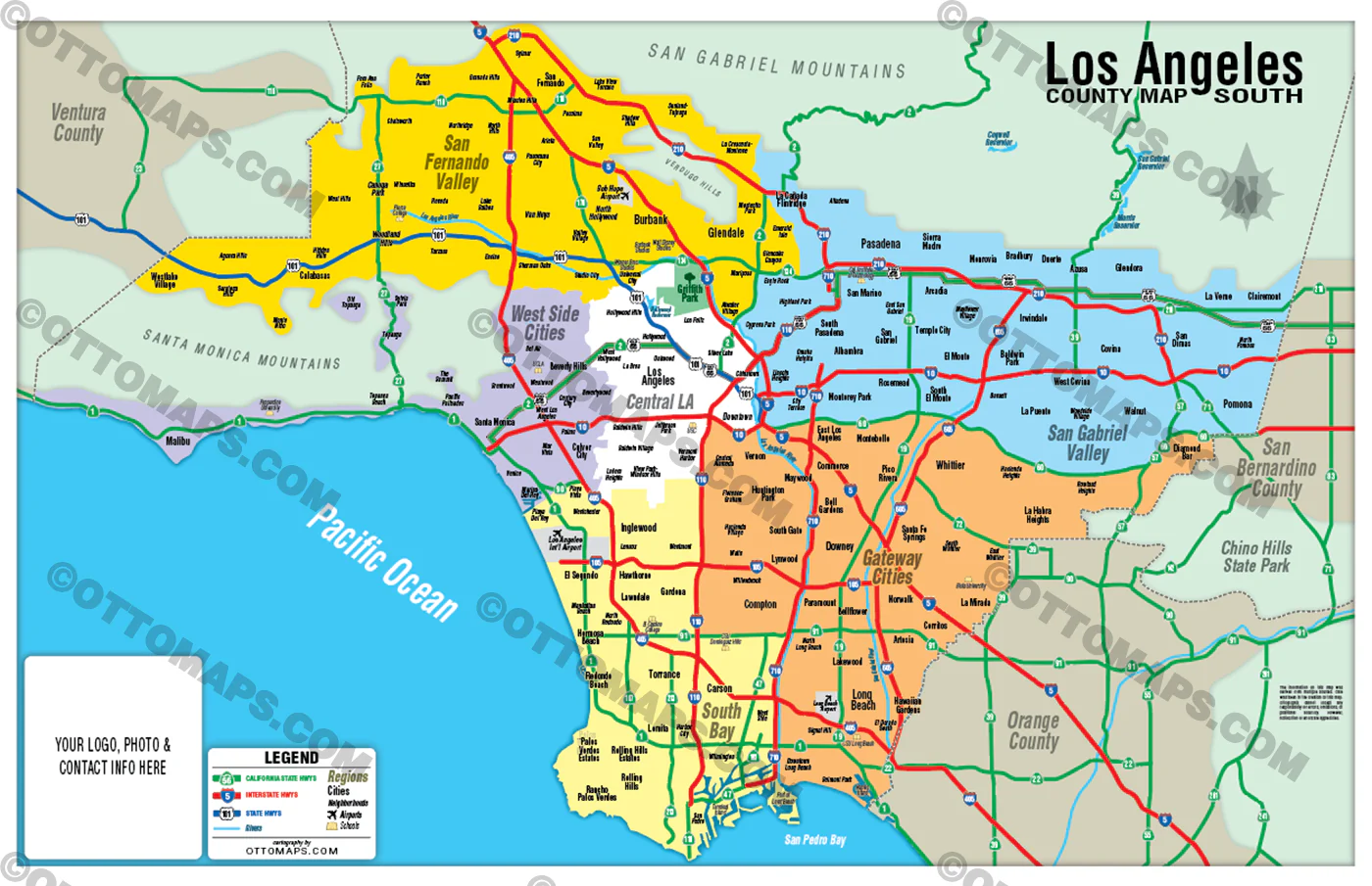
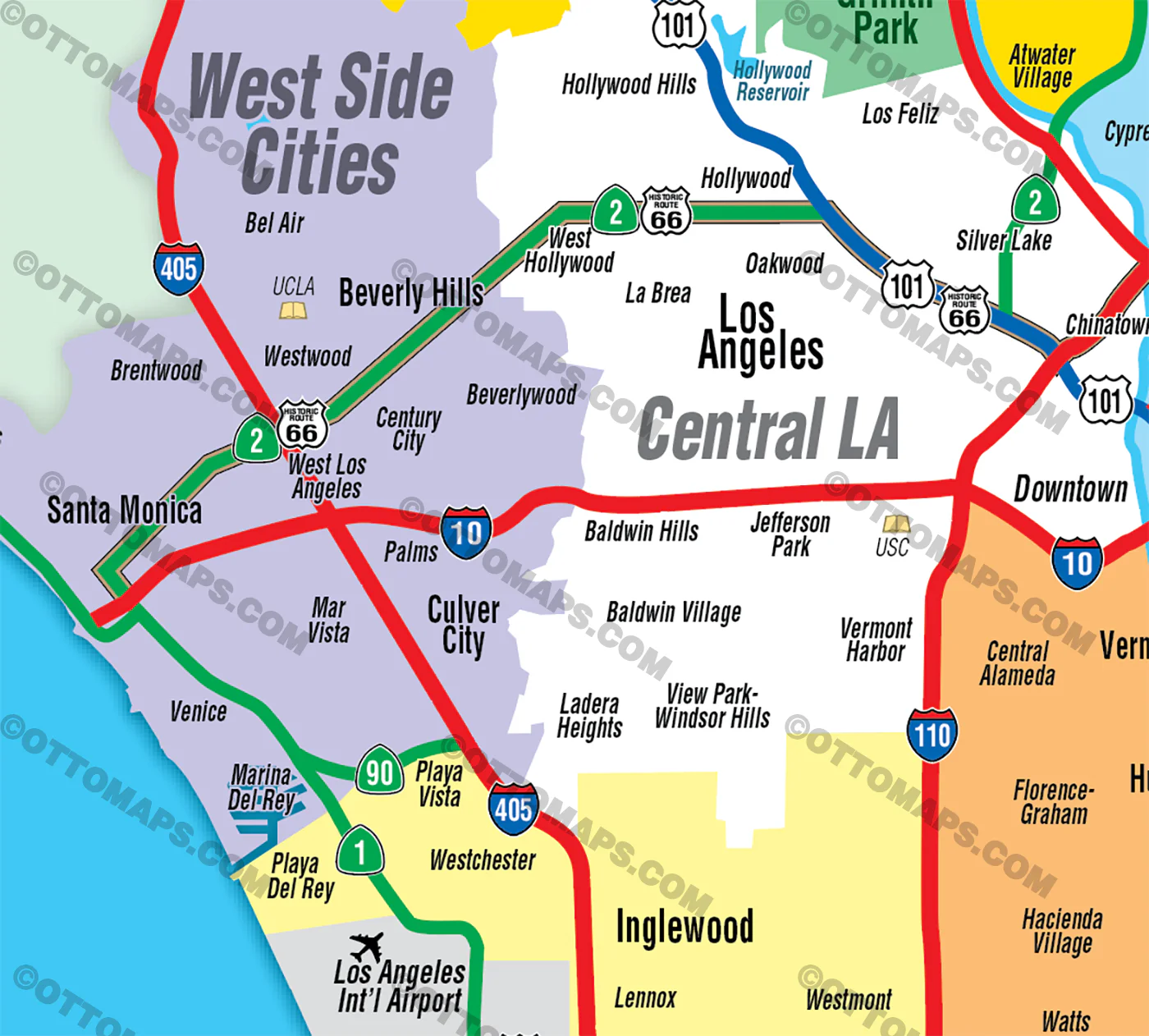
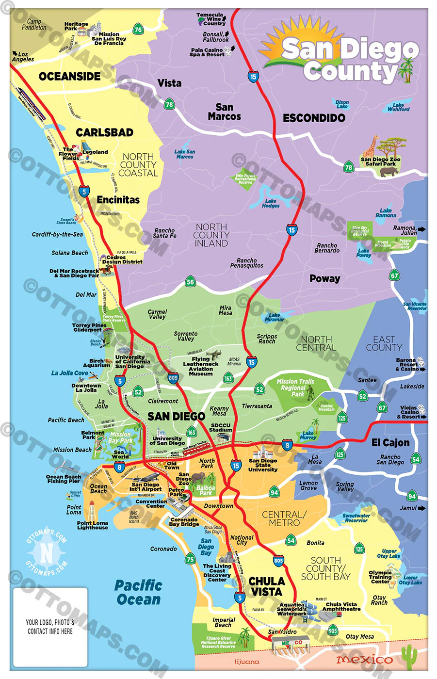
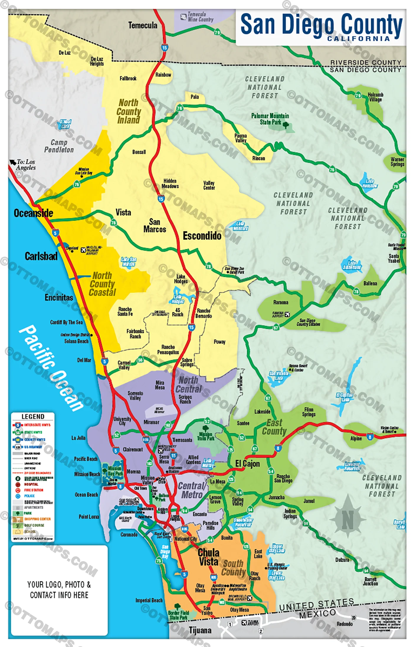
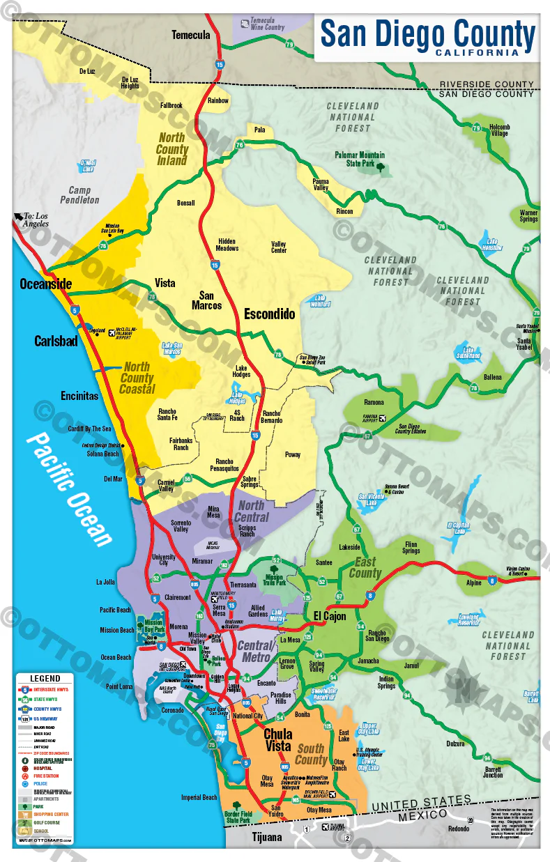
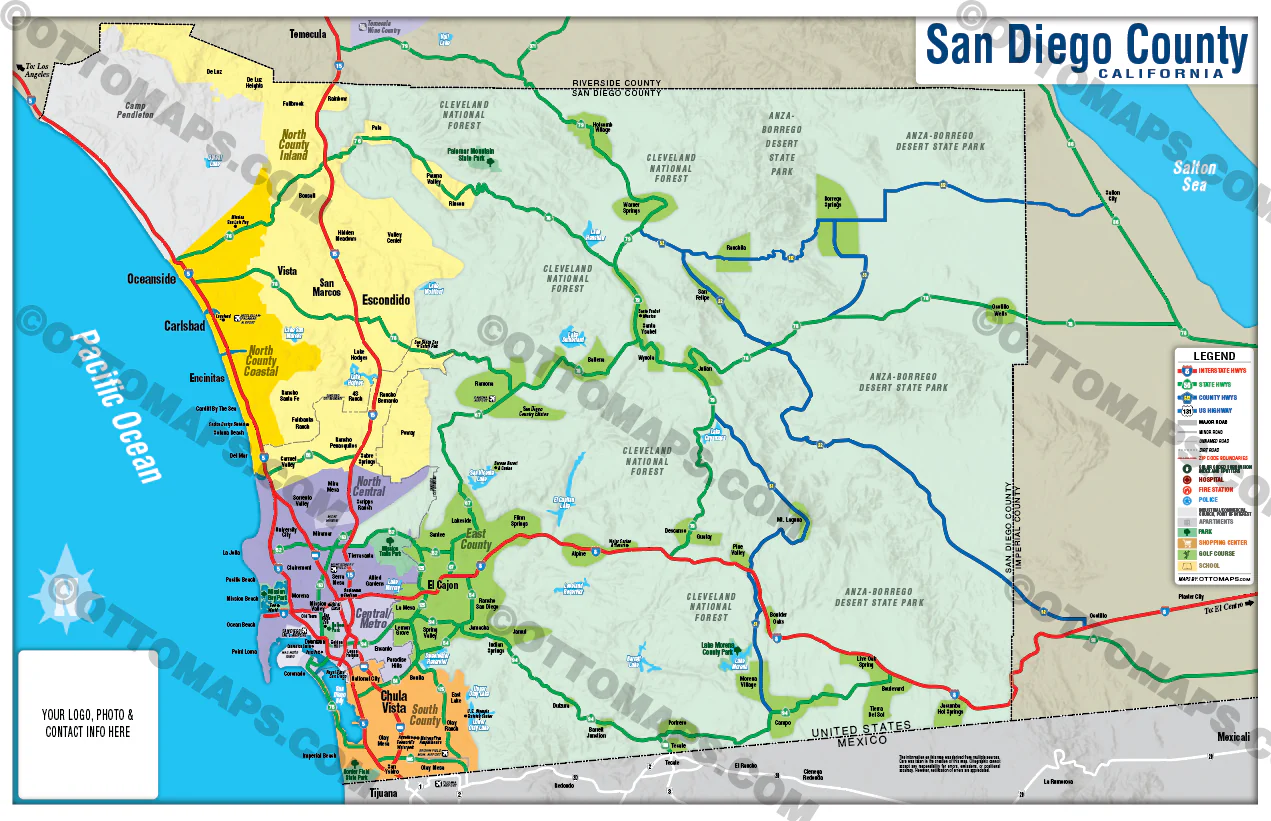
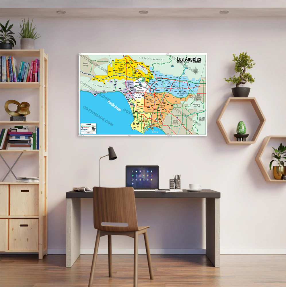
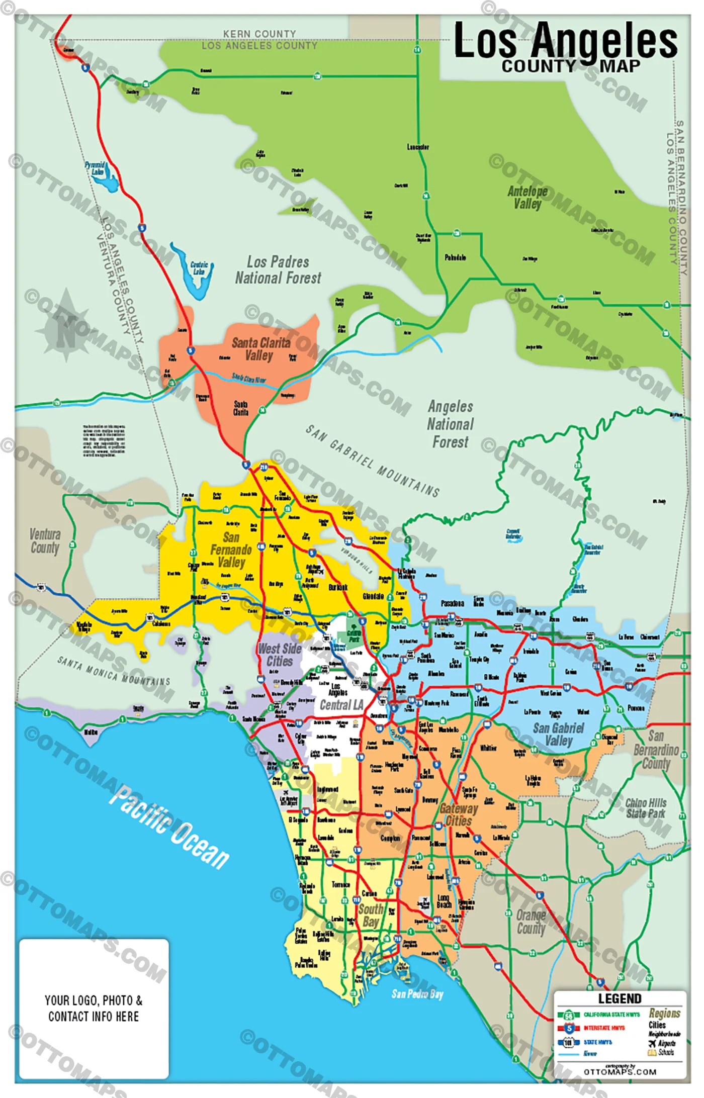
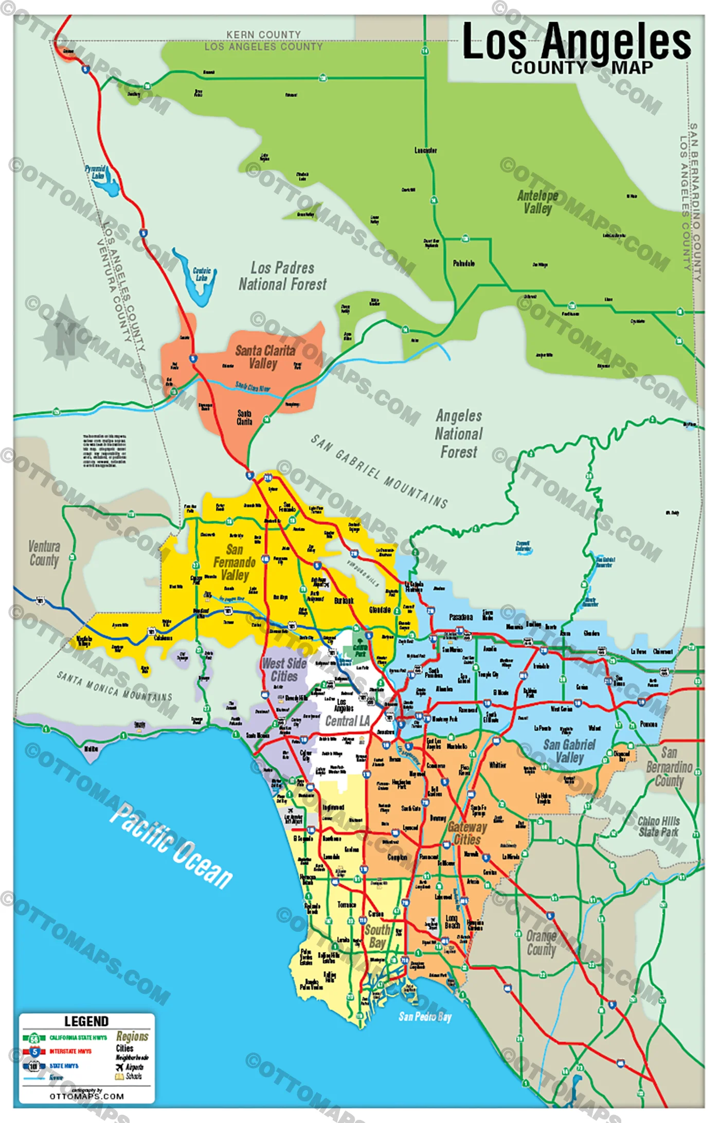
LOS ANGELES COUNTY MAP - REGIONS POSTER PRINTS
LOS ANGELES COUNTY MAP - REGIONS FILES: PDF and AI, layerted, vector, editable
PURCHASE INCLUDES:
- PDF Files - with Company Branding Box and without
- Adobe Illustrator Files and fonts (layered, editable)
- 11”x17” Vector File - enlarged to any size with out loss of quality
- Files are editable with any PDF editor
- Royalty Free / All Reproduction Rights Granted (not for resale)
- Prints not included, GET PRINTS HERE or recommend Vistaprint.com for multiple prints
- No sales tax!
AREAS:
- Central Los Angeles
- San Gabriel Valley
- San Fernando Valley
- West Side Cities
- South Bay
- Gateway Cities
- Antelope Valley
- Santa Clarita Valley
DETAILS:
- County Areas
- Arterial Street Detail
RIGHTS:
- Royalty Free
- Not for resale
- All reproduction rights granted
DISCLAIMER:
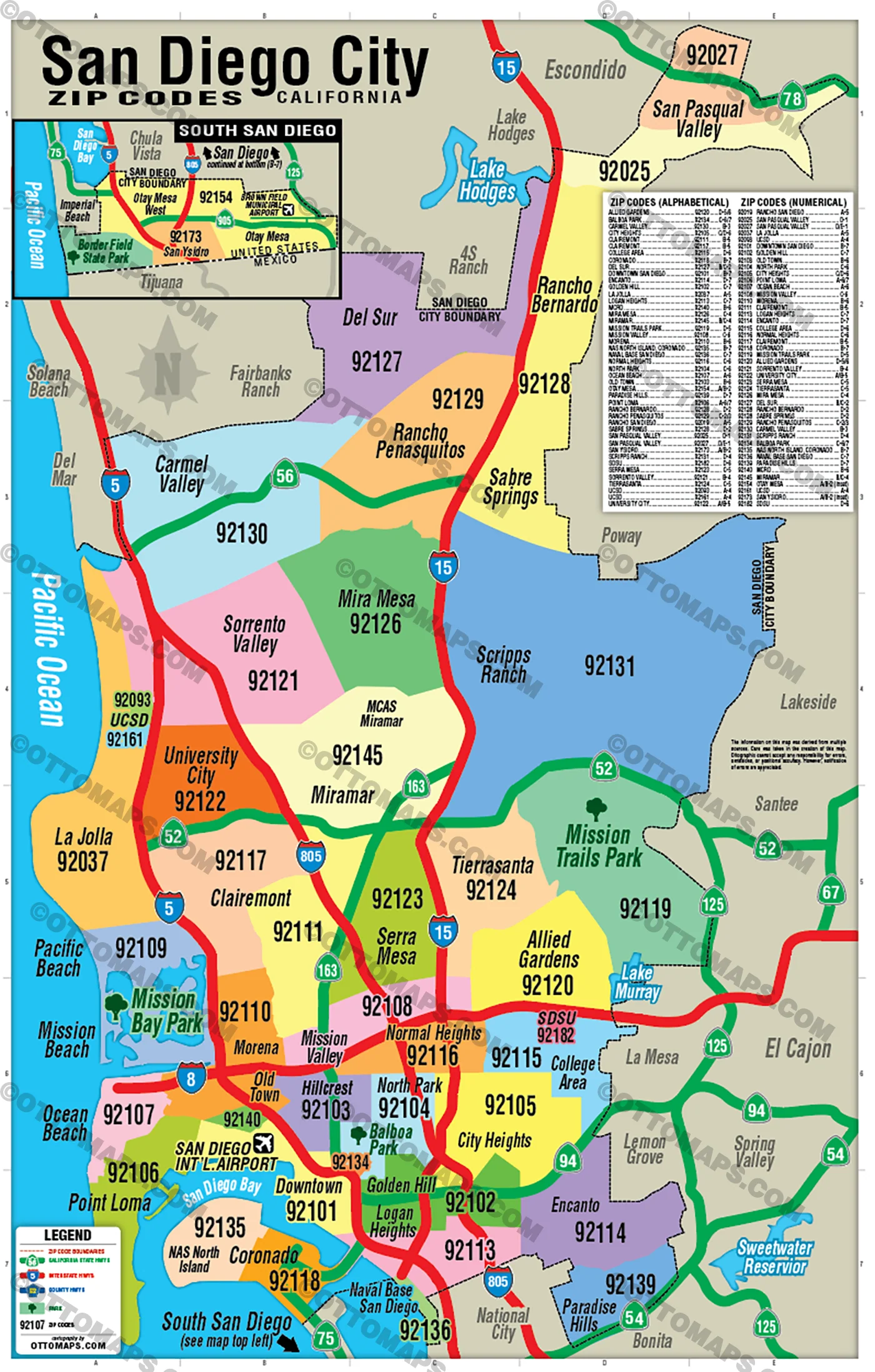
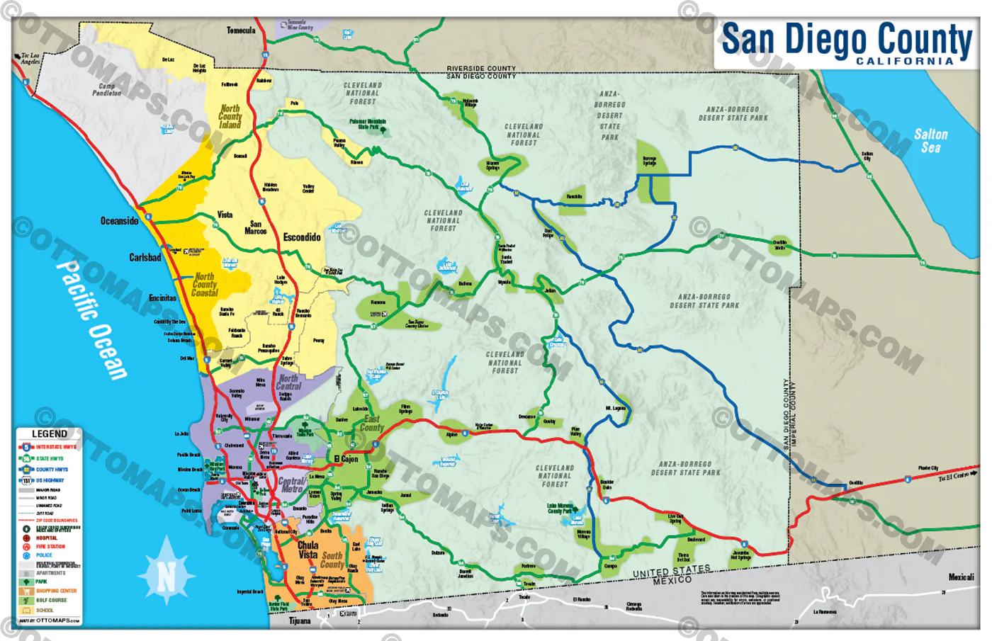
- The information on this map was derived from multiple sources. Care was taken in the creation of this map. Ottographix cannot accept any responsibility for errors, omissions, or positional accuracy. However, notification of errors are appreciated. If you find a mistake, Ottographix will fix it for no charge. Please contact us and we'll take care of it. https://ottomaps.com/pages/contact
- Maps are sold as-is. All necessary files are included for editing
- Additional customization is available from Ottographix at an additional cost. Please contact us for details and a free quote. https://ottomaps.com/pages/contact
$95.00
Los Angeles County Map - Regions Colorized (No Zip Codes) - FILES - PDF and AI—
$95.00
Product Information
Product Information
Shipping & Returns
Shipping & Returns
Description
LOS ANGELES COUNTY MAP - REGIONS POSTER PRINTS
LOS ANGELES COUNTY MAP - REGIONS FILES: PDF and AI, layerted, vector, editable
PURCHASE INCLUDES:
- PDF Files - with Company Branding Box and without
- Adobe Illustrator Files and fonts (layered, editable)
- 11”x17” Vector File - enlarged to any size with out loss of quality
- Files are editable with any PDF editor
- Royalty Free / All Reproduction Rights Granted (not for resale)
- Prints not included, GET PRINTS HERE or recommend Vistaprint.com for multiple prints
- No sales tax!
AREAS:
- Central Los Angeles
- San Gabriel Valley
- San Fernando Valley
- West Side Cities
- South Bay
- Gateway Cities
- Antelope Valley
- Santa Clarita Valley
DETAILS:
- County Areas
- Arterial Street Detail
RIGHTS:
- Royalty Free
- Not for resale
- All reproduction rights granted
DISCLAIMER:
- The information on this map was derived from multiple sources. Care was taken in the creation of this map. Ottographix cannot accept any responsibility for errors, omissions, or positional accuracy. However, notification of errors are appreciated. If you find a mistake, Ottographix will fix it for no charge. Please contact us and we'll take care of it. https://ottomaps.com/pages/contact
- Maps are sold as-is. All necessary files are included for editing
- Additional customization is available from Ottographix at an additional cost. Please contact us for details and a free quote. https://ottomaps.com/pages/contact